
Prof Carla Jaimes Betancourt, an anthropologist focusing on the Amazon, is a researcher at the Department of Anthropology of the Americas at the University of Bonn and co-director of the BASA Museum housed at the university. Her research, promoting collaborative archaeology with local Indigenous People, focuses on the social complexity in the southwestern Amazon and processes of expansion and formation of ethnic groups in the South American lowland.
In a newly published Frontiers in Environmental Archaeology article, she and co-authors present the results of interdisciplinary and collaborative archaeological research conducted in the southwestern Amazon. In the following editorial, she highlights the rich cultural heritage found at the sites and the importance of protecting these landscapes where humans have thrived for thousands of years.
by Prof Carla Jaimes Betancourt
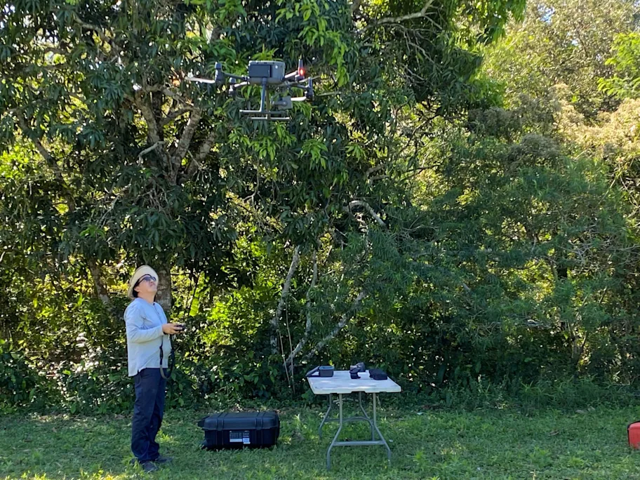
In September 2021, a multidisciplinary expedition explored one of the least-known regions of the Bolivian Amazon: the Great Tectonic Lakes of Exaltación in the department of Beni. Organized by the Grupo de Trabajo para los Llanos de Moxos (GTLM), the mission brought together researchers from the Wildlife Conservation Society, the National Museum of Natural History, the Institute of Ecology, the Biodiversity and Environment Research Center, the Aquatic Resources Research Center, and the Department of Anthropology of the Americas at the University of Bonn.
Landscapes as Living Archives
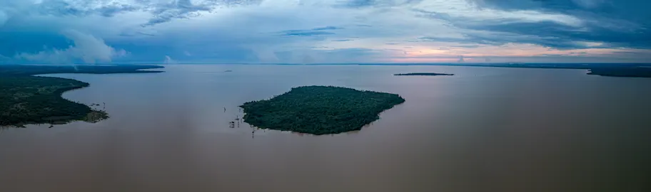
In southwestern Amazonia, the great tectonic Lakes Rogaguado and Ginebra in Bolivia reveal a profoundly human landscape, a living archive of adaptation and creativity. Beneath the grasslands and shallow waters lie monumental earthworks, raised fields, and complex canal systems that attest to millennia of human–environment interaction.
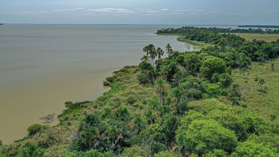
The lakes lie within the Municipal Protected Area of Grandes Lagos Tectónicos de Exaltación and form part of the Río Yata Ramsar wetland complex, recognized by UNESCO for its ecological and cultural significance. Situated in the Llanos de Moxos, a vast mosaic of savannas, gallery forests, and floodplains, the largest wetland in the Amazon basin, this landscape has long inspired fascination, even evoked in ethnohistorical account of the fabled ‘Land of Paititi.’ Yet its deeply human history is only now coming into focus.
Through survey, excavation, and LiDAR mapping, we documented several archaeological sites — Paquío, Coquinal, Isla del Tesoro, and Jasschaja — each representing a different chapter in the long history of settlement in this region.
Radiocarbon dates show successive occupations from about 600 to 1400 CE, and research revealed how communities repeatedly reshaped these wetlands. At Paquío, an early phase around 600 CE was followed by a more intensive occupation between 1000 and 1200 CE, marked by shell middens, dense ceramic deposits, and an elaborate network of canals and raised fields associated with maize-based agriculture. In contrast, Jasschaja, dated to 1300 to1400 CE, shows broader landscape transformations and greater plant diversity, pointing to intensified forest and crop management.

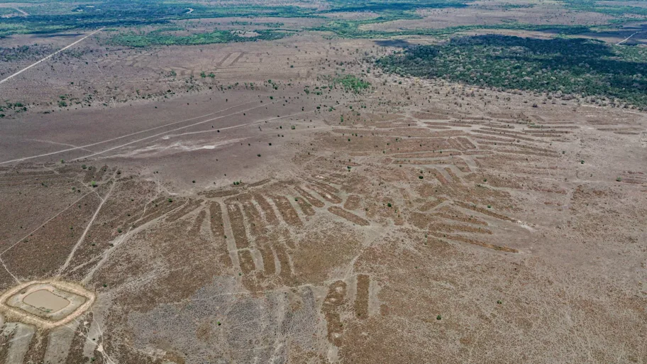
The landscape, like many across the Llanos de Moxos, is marked by geometrically shaped relief that resolves, upon examination, into circular and quadrangular ditches, drainage canals, raised fields, and clusters of mounds form an intricate system of water control and cultivation. These earthworks were carefully engineered to manage floods, channel water, and create habitable and cultivable spaces within a seasonally inundated environment. Their variety, from geometric enclosures to elongated cultivation platforms, suggests not a single plan but centuries of local experimentation and adaptation to changing ecological and social conditions. Together, they reflect the cultural diversity and long-term resilience of the peoples who shaped them.
Excavations at Paquío and Jasschaja also revealed a remarkably diverse pre-Hispanic diet, showing how ancient societies utilized the resources of a dynamic wetland. Fish such as wolf fish, peacock bass, and South American lungfish dominated the assemblages, complemented by reptiles like caimans and turtles, and mammals such as capybaras, pacas, and armadillos. Botanical evidence indicates the use of maize, legumes, and several palm species — moriche palm, corozo palm, cumare palm, totai palm, palmita, and peach palm. Together, these findings depict a mixed economy of fishing, hunting, gathering, and cultivation.
Biocultural Heritage and Collaboration in the Field
The Cayubaba and Movima communities continue to inhabit these landscapes, where exceptional biodiversity is interwoven with deep cultural history. Their long-standing presence and knowledge sustain a unique form of biocultural heritage, where ecological and cultural diversity have coevolved through centuries of interaction.
Read and download full article
During the post-Covid-19 field seasons, collaboration was grounded in dialogue and respect. Representatives of the Cayubaba Indigenous Council, encompassing 21 Cayubaba and Movima communities, helped identify research areas, guided access to culturally significant sites, and requested that certain places remain untouched. Although contact was necessarily limited for health reasons, this coordination ensured that the research aligned with community priorities and contributed to a broader understanding of the region’s living heritage.

Through the GTLM, scientists and Indigenous representatives are creating a platform that connects archaeological and ecological research with conservation. The project highlights that the Llanos de Moxos is not only a biodiversity hotspot but also a landscape profoundly shaped by human history, while supporting ongoing efforts to strengthen the management of the Yata River Ramsar site and the protected areas with which it overlaps.
Why the Past Matters for the Future
At a time when deforestation, industrial agriculture, and climate change threaten the Amazon’s integrity, the landscapes of Rogaguado and Ginebra offer more than archaeological insight: they offer lessons in sustainability. Archaeological evidence reveals long-term traditions of diversified livelihoods integrating farming, fishing, and forest management in flexible and adaptive ways. Rather than seeking to dominate nature; ancient Amazonians worked with its rhythms, transforming seasonal floods into opportunities. Although the construction and use of raised fields eventually ceased—likely as a consequence of demographic collapse and social disruptions following European colonization—this does not diminish the sustainability of their practices. For centuries, these societies maintained productive systems through their understanding of the dynamic wetlands. Their legacy challenges modern assumptions about ‘development’ and reminds us that resilience often arises from diversity: from species, knowledge, and ways of life.

Safeguarding this biocultural heritage has become a global responsibility. As the wetlands of the Llanos de Moxos continue to store carbon, regulate water, and sustain biodiversity, their conservation must also honor the people who have long cared for them. In this sense, archaeology becomes more than the study of the past: it is a bridge linking the knowledge embedded in ancient landscapes with today’s urgent conversations on sustainability and justice.
The Llanos de Moxos remind us that the Amazon has always been a biocultural landscape, dynamic, inhabited, and full of memory. Its monumental earthworks, forest islands, and living traditions reveal that the key to our shared future may lie in listening to these landscapes that remember.
The Grupo de Trabajo para los Llanos de Moxos can be visited on Facebook.
REPUBLISHING GUIDELINES: Open access and sharing research is part of Frontiers’ mission. Unless otherwise noted, you can republish articles posted in the Frontiers news site — as long as you include a link back to the original research. Selling the articles is not allowed.