Punxsutawney Phil - the famous groundhog weather oracle - called for early spring last Friday, having not seen his shadow. However, a new forecast by Arcfield Weather indicates that the above-normal temperatures across the Central US and East Coast could end as early as next week, ushering in another vicious round of winter.

"A pattern change to colder-than-normal begins next week in the central and eastern US and this change looks like it will have some staying power," Arcfield Weather meteorologist Paul Dorian wrote in a report.
Here's more of Dorian's report:
Remainder of the week
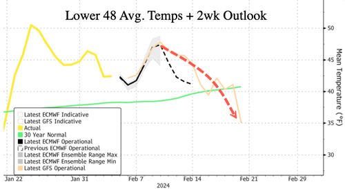
Temperatures will climb to well above-normal levels across much of the central US during the first half of this week and then that warm-up will shift to the eastern states for Friday and Saturday. In fact, temperatures on Saturday afternoon can peak in the upper 50's-to-middle 60's in the DC-to-Philly-to-NYC corridor ahead of an incoming cold front. However, the frontal passage will begin a transition to colder weather conditions in the eastern half of the nation that may very well have some staying power.
Teleconnection indices
A look at the teleconnection index known as the Madden-Julian-Oscillation or MJO which tracks a tropical disturbance indicates it will transition during February to "phases" or locations which are normally associated with colder conditions across the eastern and southern US. The MJO is the major fluctuation in tropical weather on weekly-to-monthly timescales and can be characterized as an eastward moving "pulse" of clouds and rainfall near the equator that typically recurs every 30-to-60 days. The MJO phase diagram illustrates the MJO index through different phases which generally coincides with locations along the equator around the globe. When the MJO index is within the center circle, it is considered weak and when it is outside, it is stronger and usually moves in a counter-clockwise direction. The different phases of the MJO correlate well with different temperature and precipitation patterns around the world depending on the time of year. The current forecast of the MJO suggests it will propagate into the "colder" phases of 8 and 1 later this month which usually results in colder-than-normal weather across much of the central and eastern US.
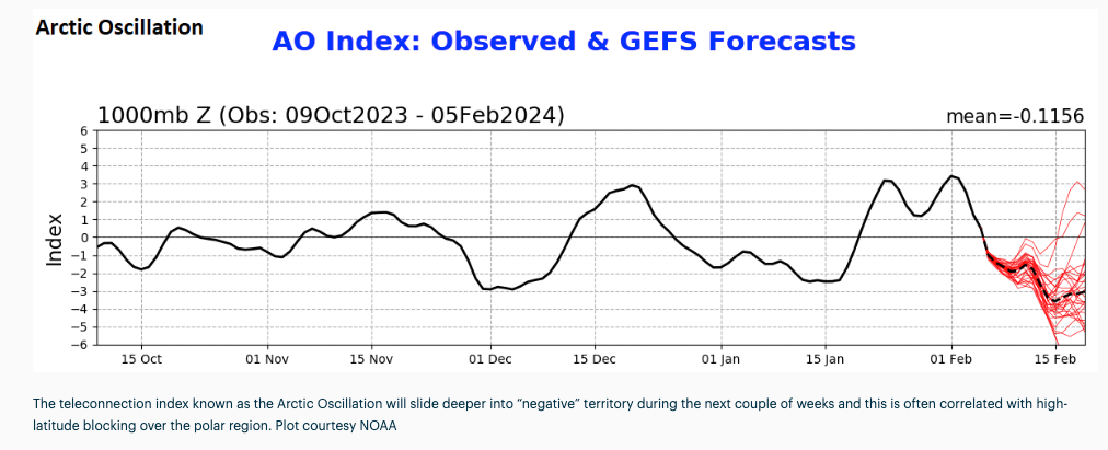
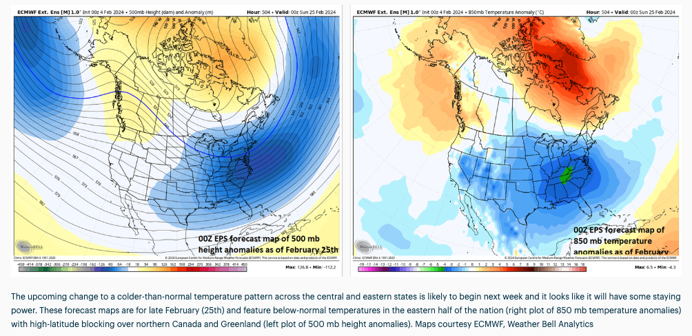
Other teleconnection indices known as the Eastern Pacific Oscillation (EPO), Pacific North America (PNA), Arctic Oscillation (AO) and North Atlantic Oscillation (NAO) are trending in directions that generally support the idea of colder-than normal temperatures during the middle and latter parts of February across the central and eastern US. Specifically, a pattern that features -EPO, +PNA, -AO and -NAO usually results in high pressure ridging across Alaska and the west coasts of the US and Canada and high-latitude "blocking" across Canada and Greenland…all of which tends to be favorable for cold air outbreaks to make their from Canada into the central and eastern US.
Stratospheric warming
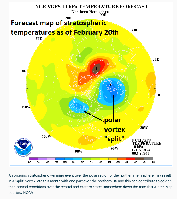
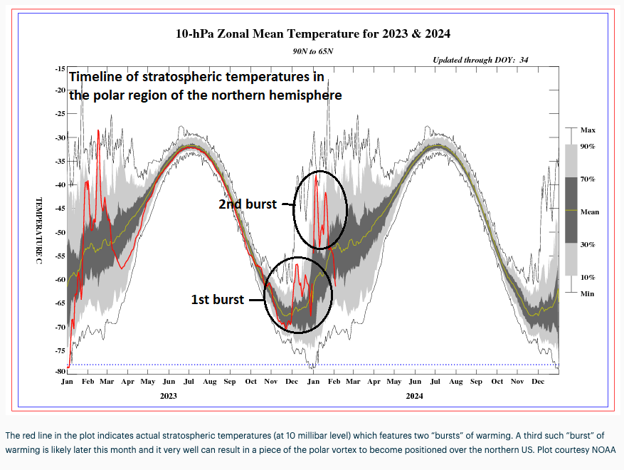
Additional support for a pattern change to colder-than-normal for the central and eastern US and one with some staying power comes from an on-going stratospheric warming event over the polar region of the northern hemisphere. This continuing stratospheric warming event has already disrupted the polar vortex this winter season and it looks like it will again.
There has been one spike in stratospheric temperatures that lasted from late November into mid-December and a second burst occurred during the early and middle parts of January. It is this second episode of stratospheric warming that supports the notion of a pattern change to colder-than-normal beginning around the middle of February across the central and eastern US as there is usually a lag time of several weeks (4-6) for an impact on temperature patterns across the US. Looking ahead, there are strong signs for another burst of stratospheric warming later this month that can result in a "splitting" of the polar vortex which is likely tom extend the colder pattern into the month of March.
Dorian provides more details about the pattern shift next week in the video below: