OpenStreetMap has open data I can use to map out all the roads and trails. This is the input dataset.
For 2D geometry, the best approach to compute the Pole of Inaccessibility appears to be to construct a Voronoi diagram of the geometry we're trying to stay away from, and to find the Voronoi vertex corresponding to the furthest-away point.
Our world is not 2D. Instead, it has varying elevation sitting on top of an ellipsoid. The grand purpose here is to compute a location that hardy people can visit and to tell everybody they did it, so extreme accuracy is not required. Thus I claim that assuming the world is locally-flat and using the Voronoi-diagram-based method is sufficient. So I construct a plane that best describes my query area and project all my input points to this plane. I use a plane that is tangent to the Earth's surface at the center of the query area. This clearly wouldn't work if trying to find the pole of inaccessibility of something as large as an ocean, for instance, but it works here.
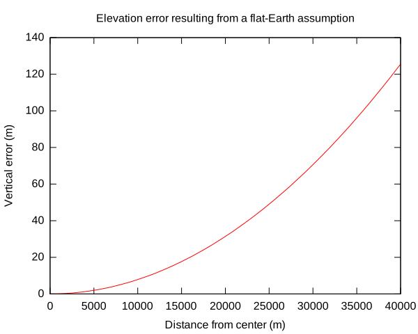
To compute the tangent plane, I assume the Earth is spherical. As I move along the tangent plane away from the point of tangency, the elevation error grows:
E = sqrt(Rearth2 + d2) - Rearth
The San Gabriels are about 80km across, and the tangent plane sits in the middle, so at worst d = 40km and the error is about 125m. That's plenty good enough. Plot (source):

I ignore the ellipsoid shape of the Earth outright. I ignore the topography as well, since including it in my distance metrics would require a fancier algorithm than making a Voronoi diagram, and it would make the notion of "inaccessibility" more ambiguous.