How an offline app, built by volunteers, became a key tool for first respondents during the earthquake response in Venezuela.
On the second day after the earthquake, Anton went down to what everyone had started calling ground zero, the hardest-hit area. He'd been helping in Caracas before, but now he was heading into a zone with no cell coverage. He didn't have to improvise: he already had the app on his phone.
"CoMaps turned out to be really useful for me because I entered a zone with no coverage and needed it right away," Anton recalls.
A few days later, he joined as a volunteer with a rescue team that had come from El Salvador, firefighters, Civil Protection, several different rescue units, operating remotely, taking instructions from a command center back in their home country. Most of the team didn't know CoMaps. Only one person had access to a map and was guiding the rest. Anton started helping with logistics: when the command center asked to move the team from one point to another, he was the one who could find the destination, if it was mapped at all.
Along the way, he discovered that the team's map coordinator was using a different, much more limited navigation app, one that didn't carry the detail that comes from a community of volunteers mapping a place, or the ability to work fully offline in a zone with no signal. When Anton showed him CoMaps, it was, in his words, "a discovery he loved making."
That's the kind of moment that made us want to hear the fuller story. So we sat down with Anton Wenemoser and Bastian Greshake Tzovaras, co-founders of CoMaps, to talk about how the app was used during the Venezuela earthquake activation, and how a collaboration between the Humanitarian OpenStreetMap (HOT) and CoMaps came together in real time. Here's what they told us about the app, the timing, and what they hope comes next.
A map that lives off its community
CoMaps is an app built on OpenStreetMap data, map data edited collaboratively, "something like Wikipedia," explains Anton, one of the project's founders. Non-commercial, fully open source, and designed to work 100% offline: once you've downloaded the map for a region, the app keeps working even without internet or cell coverage, relying only on your phone's GPS. By design, it's ideal for emergencies.
But for much of its first year, CoMaps had a major limitation: updating the maps took days. Processing raw OpenStreetMap data into maps ready for use required a powerful server, and every map update depended on an app update, subject to the app stores' own review processes.
That changed months before anyone needed it to
CoMaps and HOT had already been in conversation before the earthquake. In April, Anton and Bastian, also on the CoMaps team, presented the project to HOT's Geospatial Tech Working Group. Technical improvements had already been made, like the ability to share downloaded maps from a local device, simply because they fit the project's vision, not because HOT had asked for them.
"Many of the things we've already done that turned out useful to HOT are not things we sat down and thought would be useful to HOT, we were already working on them because they generally fit the vision we have for CoMaps," Bastian explains. "We wanted people not to rely on us as the gatekeepers of the maps. And it turns out that's also really useful for deploying maps in the field."

During the first phase of the response, volunteers mapped and updated the map on Tasking Manager, data that was then updated in CoMaps. Read more
Between April and the earthquake, the team decoupled map updates from app updates, and with a more powerful server, processing time dropped from 10 days to about 3. The result: fresh map data released every week, for the whole planet.
When Emilio Mariscal, from HOT's team, reached out asking if they could get fresh maps of Venezuela, CoMaps was already generating one.
Recently, during the Venezuela Earthquake activations, I learnt that the OSM map in CoMaps is now being updated weekly, with a recent update that made it possible for people in Venezuela to have the thousands of buildings mapped by volunteers in the HOT's Tasking Manager available on the map for responding to the disaster. Kudos for this team and my special thanks to Bastian Greshake Tzovaras who quickly answered to all my questions about it.
— Emilio Mariscal, Software Engineering Manager, HOT
"It was just very lucky with the timing," Bastian says of the coincidence. But it wasn’t luck, the work by the amazing CoMaps team has built on months of prior work: the thousands of buildings mapped by volunteers through HOT's Tasking Manager reached the screens of people responding on the ground.
The bridge between the data and the people who need it
That may be CoMaps' most important contribution: it isn't built for geospatial data specialists, it's built for everyone. Which makes it usable by organizations that don't have the technical capacity to download and analyze OpenStreetMap data directly.
Céline Jacquin, HOT's Latin America Senior Manager, put it this way:
We've had a direct dialogue so that this everyday-use app would put emergency needs more on its radar, that's not its focus, and instead of updating its base and navigation map a few times a month, do it with total regularity, following the rhythm of emergency mapping on OSM. That allows it to be used by actors on the ground who don't know how to download and analyze OSM data, but need to move around for their logistics. Techo, the Red Cross, and other actors can now see the mapping very quickly in a navigation app.
Bastian compares it to photography: "the best camera is the one you actually have with you, because if the camera just sits at home, you never take any pictures." The same is true of maps. The best map app in the field is the one already in your pocket, the one you already know how to use, not the one that requires training in the exact moment there's no time left to learn.
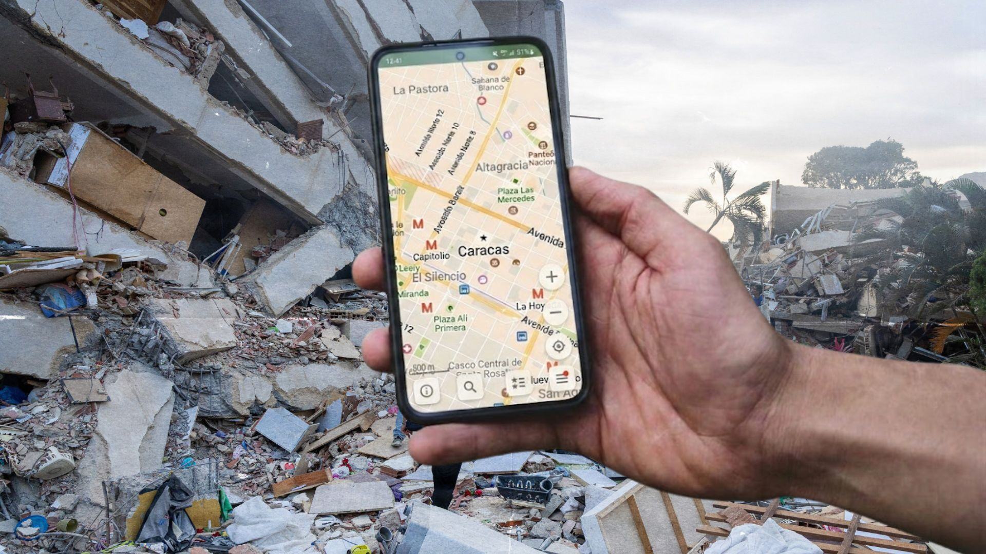
Background: residents of Venezuela carry out search and rescue efforts in La Guaira on June 28, 2026.
Credit: Cpl. Daniel Garcia, 24th Marine Expeditionary Unit / U.S. Marine Corps, via Wikimedia Commons.
Overlay: screenshot of the CoMaps map of Caracas. Source: CoMaps. Read more
What's next
The CoMaps team works as volunteers, and getting fresh maps to people responding to a disaster is part of why they do this work at all. Today, when an emergency hits, the team can prioritize an update and have new maps ready to download in the field about 35 hours later. Their vision for the future goes further: region-specific updates every 12 hours, instead of one weekly update for the entire planet, so communities affected by a disaster can rely on maps that reflect what was just mapped, not what was mapped a week earlier.
"I think our missions are quite aligned when it comes to what we do and why we do it," Bastian says. For Anton, knowing CoMaps is one of the tools HOT relies on is deeply meaningful, the project exists for a humanitarian purpose, not a commercial one, and that's its own reward: knowing it's serving humanity. Becoming a real part of the bridge HOT builds between humanitarian response and OpenStreetMap, he says, is one of the team's biggest goals.
Meanwhile, in Venezuela, a rescuer who once relied only on a much more limited navigation app now also has CoMaps on his phone. And in the next emergency, anywhere in the world, someone is likely to find their way again, thanks to a map built building by building, by volunteers who never met each other in person.