
Folks in the Mid-Atlantic and Northeast are waking up this morning to a power nor'easter with damaging winds, coastal flooding, and heavy rain.
Coastal wind gusts reached 62 mph on Nantucket, 58 mph in Bethany Beach, Delaware, and 55 mph in Chatham, Massachusetts, according to local weather data. New York's JFK Airport recorded a 53 mph gust. Winds are expected to continue through Sunday.
"Powerful nor'easter bringing major coastal flooding & damaging winds to the East Coast," NWS Weather Prediction Center wrote on X around lunchtime in New York, adding, "Roads are underwater at the Jersey Shore & gusts hit 64 mph on Nantucket. More flooding likely at high tides tonight & Sun. Turn Around, Don't Drown."
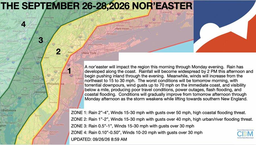
Private weather forecasting firm NY NJ PA Weather provided a detailed map of the impacts for the Northeast through the weekend:
A nor'easter will impact the region this morning through Monday evening. Rain has developed along the coast. Rainfall will become widespread by 2 PM this afternoon and begin pushing inland through the evening. Meanwhile, winds will increase from the Northeast to 15 to 30 mph.
The worst conditions will be tomorrow morning, with torrential downpours, wind gusts up to 70 mph on the immediate coast, and visibility below a mile, producing poor travel conditions, power outages, flash flooding, and coastal flooding. Conditions will gradually improve from tomorrow afternoon through Monday afternoon as the storm weakens while lifting towards southern New England.
ZONE 1: Rain 2" -4", Winds 15-30 mph with gusts over 50 mph, high coastal flooding threat.
ZONE 2: Rain 1" -2", Winds 15-30 mph with gusts over 40 mph, high urban/river flooding threat.
ZONE 3: Rain 0." - 1", Winds 15-30 mph with gusts over 30 mph
ZONE 4: Rain 0.10"-0.50", Winds 10-20 mph with gusts under 30 mph
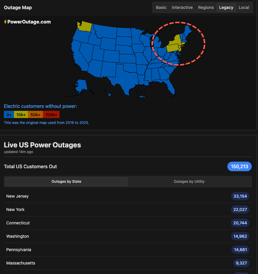
According to the utility tracking website PowerOutage.us, more than 90,000 customers across New Jersey, New York, Connecticut, and Pennsylvania are without power.
Footage:
The good news is that no hurricanes have formed in the Atlantic so far this year, with a strengthening El Niño helping suppress hurricane development by increasing wind shear, which makes it harder for storms to organize and intensify.